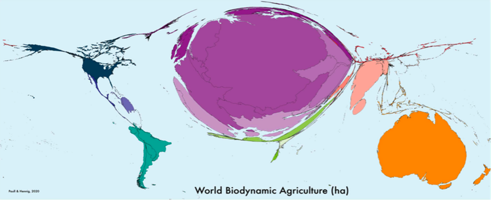
How has biodynamics developed and spread around the world over the last 100 years? John Paull and Benjamin Hennig's 2020 study is the first to provide an area-based world map of biodynamic agriculture. To this end, they determined all biodynamically farmed areas worldwide and represented them graphically using a Peters projection. The resulting biodynamic world map provides an insight into the spread of biodynamic agriculture and shows some enormous differences between countries, regions and continents.
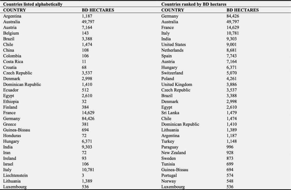
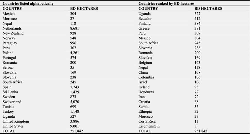
For this cartographic representation, a total of 55 countries were taken into account, in which over 250,000 hectares of certified biodynamic land exist. Most of the data comes from Demeter International, supplemented by previously unpublished information from Australian Demeter certification bodies. As a visualization method, the authors chose a density- equalizing area projection (Peters projection), in which countries are distorted proportionally to their biodynamic hectares: Countries with an above-average density of biodynamic areas are inflated, while countries with a below-average density are shown at a reduced size.